 Home
Home
Bottom Line: Remote sensing instruments measure concentrations of atmospheric
trace gases
such as NO2 and aerosol optical depth with implications for PM2.5 concentrations.
These satellite-derived data are capable of characterizing air pollution in areas where air
quality monitoring stations are limited (i.e., predominantly rural communities and the global south). These
data can also be used to validate model simulations and identify areas and sources that may be under- or
over-estimated.
Research: We evaluate remote sensing observations from satellite instruments such as TROPOMI and
TEMPO along with aircraft remote sensing from campagins such as TRACER-AQ against surface-level monitors,
Pandora spectrometers, meteorogology reanalysis products, and earth-system modeling to understand biases and
uncertainties in remote sensing data and to better understand the health and equity implications of air
pollution.
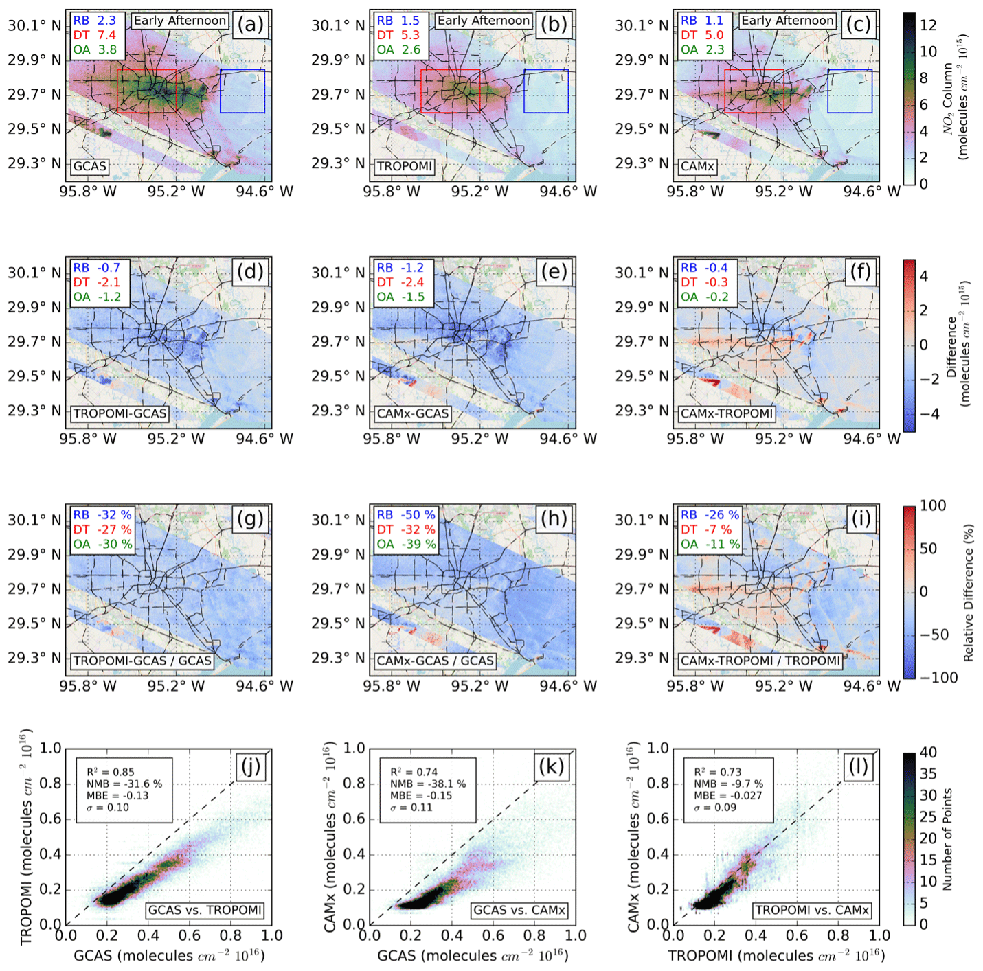
In the above figure, we characterize column concentrations of NO2 from airborne remote sensing (a), satellite remote sensing (b), and earth-system modeling (c) and then intercompare the different products (d-i).
Nawaz, M.O., Johnson, J., Yarwood, G., de Foy, B., Judd, L., and Goldberg, D. L.: An
intercomparison of satellite, airborne, and ground-level observations with WRF-CAMx simulations of NO2
columns over Houston, Texas, during the September 2021 TRACER-AQ campaign, Atmos. Chem. Phys., 2024,
6719-6741
10.5194/acp-24-6719-2024
Goldberg, D.G., de Foy, B., Nawaz, M.O., Johnson, J., Yarwood, G., Judd, L., Identifying
Sources of Urban NOx Emissions in Houston, Texas using Remote Sensing Aircraft Measurements and Source
Apportionment Regression Models. ACS ES&T Air.
10.1021/acsestair.4c00097