 Home
Home
Bottom Line: Estimates of surface-level pollution are vital for epidemiological, risk assessment, and
environmental justice studies; however, there are challenges in characterizing pollution at relevant
spatial and temporal resolution. Satellite-derived data can provide clues about pollution levels at the
surface, but additional data integrated through determinstic, statistical, and machine learning methods
are needed to convert columns to surface-level estimates.
Research: We estimate surface-level pollution from remote sensing data through deterministic
modeling, statistical methods, and machine learning approaches. Specifically, GEOS-Chem derived
column-to-surface concentration relationships are applied to satellite remote sensing to infer surface-level
pollution concentrations. Alternatively, we integrate land-use information and meteorology with
remote-sensing data through land-use regression modeling and machine-learning approaches to synthesize
surface-level pollution datasets.
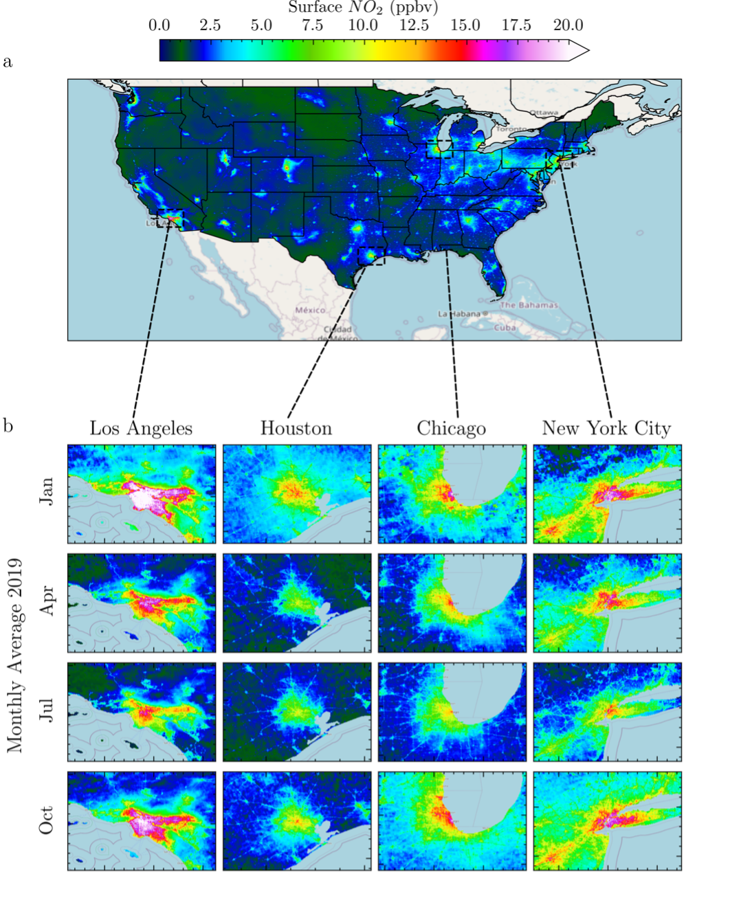
The above figure presents surface-level NO2 concentrations derived from TROPOMI data using a LASSO land-use regression approach for the continental US in 2019 as an annual average (a) and for specific months (b). This dataset is available for download here.
Nawaz, M.O., Goldberg, D.L., Kerr, G.H., Anenberg, S.C. TROPOMI satellite data reshape NO2 Air Pollution Land-Use Regression Modeling Capabilities in the United States. ES&T Air 2024. 10.1021/acsestair.4c00153