 Home
Home
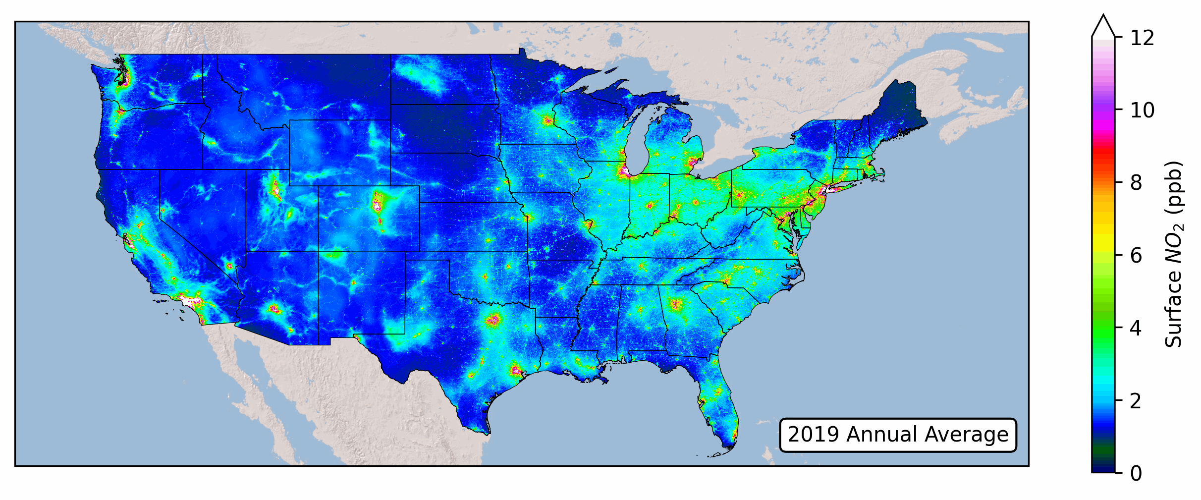
This dataset provides estimates of monthly and annual average surface-leve nitrogen dioxide
(NO2) levels across the
continental United States. These estimates are derived using a LASSO land-use regression built by
integrating remote-sensing
observations from the TROPOspheric Monitoring Instrument (TROPOMI) on the Sentinel-5
Precursor satellite, land-use data from Open Street Maps and Google Earth Engine, and meterological
reanalysis data from ERA-5.
Annual and Monthly 24-hour average US Surface NO2 (v1.US.D.01): Download Here
Nawaz, M.O., Goldberg, D.L., Kerr, G.H., Anenberg, S.C. TROPOMI satellite data reshape NO2 Air Pollution Land-Use Regression Modeling Capabilities in the United States. ES&T Air 2024. 10.1021/acsestair.4c00153